Wilkinson School will be 100 years old in 2015! We’re collecting historical photos of the school; if you have any you would like to share with us, please send our web team an e-mail.
Wilkinson Junior PS opened in September, 1915 as North Leslie Street School with 337 students enrolled. On November 4, 1915 the Board decided “that the new school on Leslie Street North be named Wilkinson School after W.C. Wilkinson, Secretary-Treasurer to the Board 1874-1919.” (TBE Minutes 1915) That same year ‘Leslie Street North’ was renamed ‘Donlands Avenue’. (Thanks to TDSB Archivist Greg McKinnon for this information.)
The picture below dates from the 1920’s and is the earliest photo on record. You can see that the northern wing was under construction and that the current gymnasium did not yet exist.
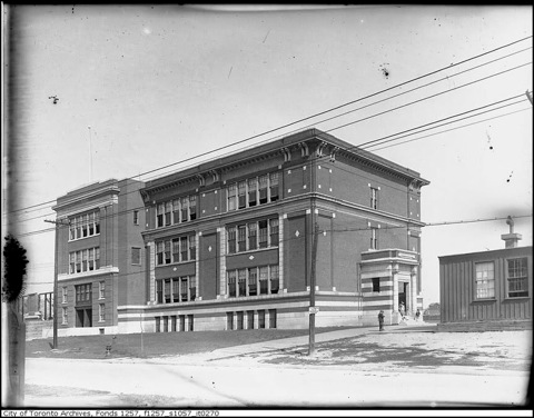
City of Toronto Archives, Fonds 1257, Series 1057, Item 270
In this picture the northern wing and fences have been completed.
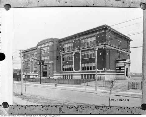
City of Toronto Archives, Fonds 1257, Series 1057, Item 202
These pictures show what the neighbourhood looked like around the time that Wilkinson was built. The first was taken from Pape and Danforth looking east towards Donlands. The second was taken on Woodycrest Avenue looking south toward the Danforth.
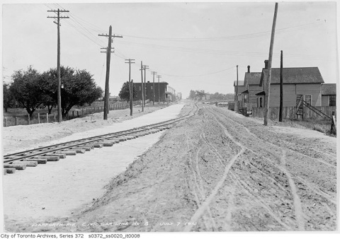
City of Toronto Archives, Series 372, Sub-series 20, Item 8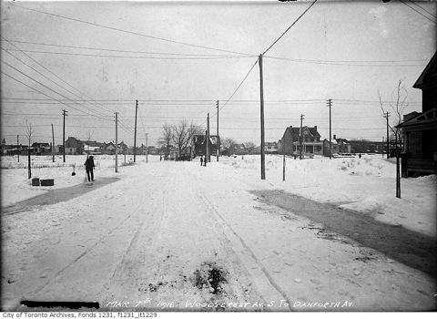
City of Toronto Archives, Fonds 1231, Item 1229
The Goad’s Fire Insurance Map of 1913 shows an empty area where Wilkinson school was later built... look below where “Ward 1” is printed near the centre of the map. Leslie Street to the left was later renamed ‘Donlands’ while Fifth Avenue was renamed ‘Baltic’. Ten years later, the Goad’s Fire Insurance Map of 1924 (the second map below) shows Wilkinson School surrounded by houses. Riverdale Technical School is also complete, but the two schools are separated by Caithness Ave. This segment of road was later removed and became part of the Wilkinson school field.
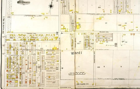
City of Toronto Archives, Goad’s Atlas of the City of Toronto and Suburbs, 1910 revised to 1912 - Detail from Plate 112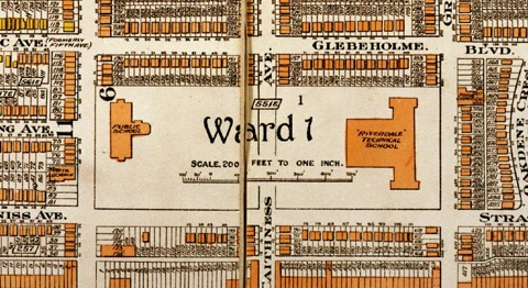
City of Toronto Archives, Goad’s Atlas of the City of Toronto and Suburbs, 1924 - Detail from Plate 112
In 1948 Donlands avenue was widened; these two pictures were taken in April while this work was being done.
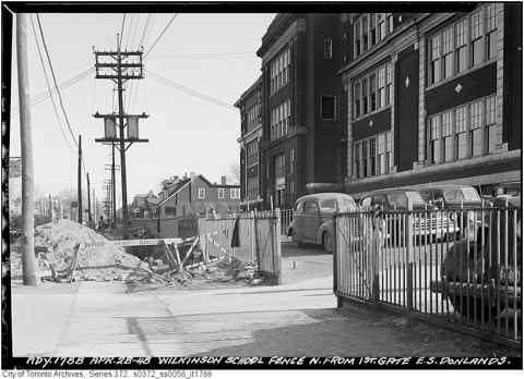
City of Toronto Archives, Series 372, Sub-Series 58, Item 1788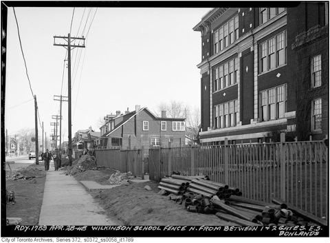
City of Toronto Archives, Series 372, Sub-Series 58, Item 1789
The following two pictures look north from Strathmore toward Wilkinson. The first was taken before Donlands was widened, the second afterwards.
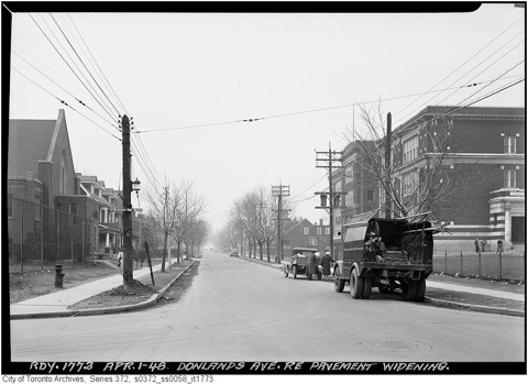
City of Toronto Archives, Series 372, Sub-Series 58, Item 1773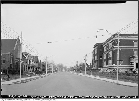
City of Toronto Archives, Series 372, Sub-Series 58, Item 1859
Here are another pair of before and after pictures; they look north up Donlands from the Danforth.
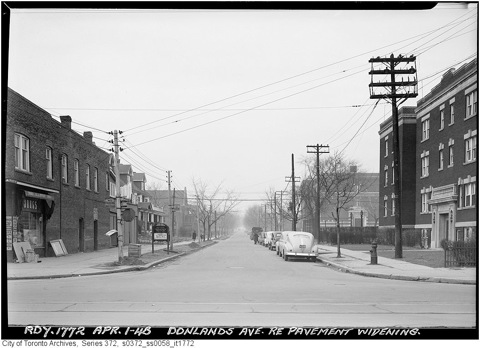
City of Toronto Archives, Series 372, Sub-Series 58, Item 1772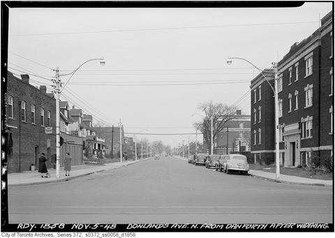
City of Toronto Archives, Series 372, Sub-Series 58, Item 1858
All photos are from the City of Toronto Archives and are used by permission.